


News
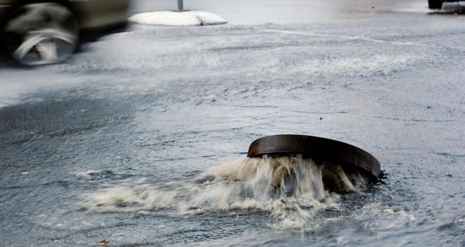
With flooding being a concern for most places on earth and flood frequency predicted to increase across 42% of Earth’s land regions by the end of the century, integrated catchment modelling is a key element of most flood risk management responses.
Computational flood modelling has been in use for more than 50 years. Historically, flood modelling would only assess the impacts of flooding from river systems. This resulted in the misrepresentation of flood risk as the link between surface and subsurface flows wasn’t considered.
An unrealistic assessment of flood risk can lead to catastrophic consequences that could cost significant amounts in terms of infrastructure, but also lives.
With technological advancements, this understanding of how different flood mechanisms affect the whole catchment has evolved.
What if we showed you how Flood Modeller, our industry-leading river, floodplain and urban drainage modelling software, offers an integrated catchment modelling solution, all within a single environment?
in flood damage annually around the world
increase in flood frequency predicted by 2100
“Urban areas worldwide are seeing an increased frequency of extreme, high-intensity storm events that cause severe flooding. Historic practices of filling natural waterways have reduced overland flow opportunities and increased the risk to public health and safety. Integrated catchment modelling allows engineers to understand surface flow dynamics and enables visualization techniques for a wide audience “see” the problem. This enables collaborative planning and design of resilient blue-green flood mitigation solutions that work with the neighborhood fabric.”
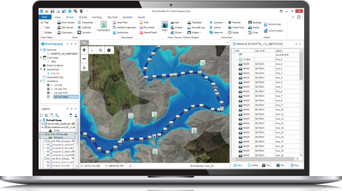
An inside look at the Flood Modeller program

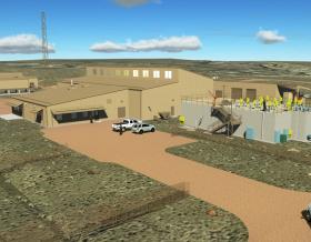
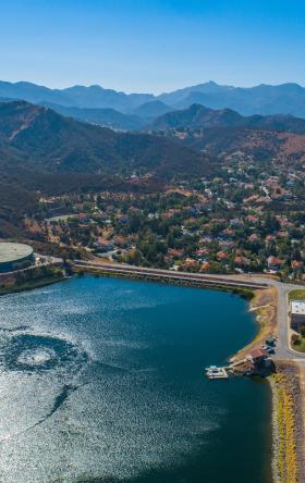
An aerial view of the City of Colorado Springs
The rapid growth of urbanization over the years has led to building homes, businesses and infrastructures on floodplains. More frequent intense rainfall events, as a result of climate change, has led to many existing urban drainage systems exceeding their capacity. It is paramount to be able to quickly and accurately understand the risks and implement the appropriate response measures.
Whether it is to build flood defence infrastructure to avoid or redirect flooding in the first place or put in place adequate emergency plans to evacuate residents and protect infrastructure, flood modelling is the first point of call and it needs to be fast, comprehensive and accurate.
With over 40 years of dedicated development, Jacobs’ Flood Modeller software provides a fully integrated 1D and 2D modelling solution which transforms the way we undertake flood risk modelling.
The industry-leading river, floodplain and urban drainage modelling software, provides a wide-range of features and capabilities to better understand flood risk in urban areas.
Flood Modeller’s fast and robust solvers provide a fully integrated solution where you can model channels using the 1D river solver, or its 2D solver to model surface water flow, while linking to the 1D urban solver to model the interaction with and the impact on the drainage network. You can also input hydrological data, to account for different return period events and climate change scenarios. Such a comprehensive solution means that many factors can be considered when carrying out a flood management study hence optimising decision making and improving the protection of our communities.
Subjected to extensive testing and benchmarking exercises, Flood Modeller offers a cost-effective solution trusted by many local authorities, government agencies, engineering consultants and insurance companies around the world.
We used Jacobs’ Flood Modeller 1D urban solver to model the Little Shooks Run drainage basin within the City of Colorado Springs, allowing us to not only model flood water on the surface but also to dynamically link to the subsurface drainage system beneath. Doing so meant that water could dynamically flow between the surface and subsurface during a simulation.
Linking the 1D urban solver to Flood Modeller’s 2D solver allowed us to better understand the uncertainty of surface flow patterns in the sub-basin once the drainage system capacity is exceeded. The solvers also made it possible to compare the existing inlet capacity to the overland street conveyance to understand when different locations became at risk of flooding.
We then used the model to understand how blockages in a culvert within the sub-drainage basin reduced the capacity of the local system, leading to water being discharged onto the surface upstream. The model showed how in some locations, water was then able to flow overland and back into the drainage system downstream of the blockage, while in other locations water leaving sub-drainage system ponded and could not re-enter the system. The linked model provided vital understandings into how the subsurface drainage basin influenced the surface water conveyance of flood waters.
Next, we applied to test the impact of a range of potential solutions to reduce flooding on the surface, such as incorporating additional inlets into the drainage system, adding storage facilities and increasing pipe capacity. The result was a set of possible approaches that could be adopted by city officials and planners to reduce flood risk arising from intense thunderstorm events in the Little Shooks Run drainage basin.
Flood Modeller is an industry-leading flood modeling software which enables engineers and scientists to deliver faster and more accurate results by simplifying the modelling of river, surface water, and urban drainage systems, and removes the need to use other software.

As the world is experiencing more severe weather events, communities need to make long-term preparations. In this episode of Inflection Points, Bryan Harvey, Jacobs' Vice President and Head of Major Programs and Projects Group, EMEA, talks about how the number and severity of floods and droughts around the world are encouraging new ways of planning to mitigate the impacts.

Jacobs was selected by England's Environment Agency to design, develop and implement the National Flood Risk Assessment 2 (NaFRA2), a pioneering cloud computing system that will help create a step-change in the quality and scope of England's national flood risk information.

The frequency and intensity of urban flooding has had devastating impacts on exposed communities across the globe, from the economic cost of damage and disruption, to mental and physical health and displacement. The challenge in managing this hazard is complicated as the cause of floods is often poorly understood and mitigation can be secondary to water quality considerations for sewer programs. However, by taking a holistic approach to understanding the causes and developing solutions, mitigating urban flooding presents opportunities to deliver improvements to neighborhoods and communities. This webinar examines the causes of urban flooding, the opportunities available from a proactive approach to mitigation and the importance of community engagement in understanding the problem and developing solutions.