


News
It’s a bird, it’s a plane. Wait no, it’s the International Space Station (ISS)! Even if you live in a big city, you might be able to spot the station overhead on a clear day because it’s powered by an acre of solar panels.
The largest manmade object in space, ISS remains in continuous orbit an average of 240 miles above Earth’s surface and in 24 hours, it makes approximately 16 orbits of Earth, traveling through 16 sunrises and sunsets and covering more than 90% of global population.
It’s no secret that global predictions for an unpredictable climate come with increased disaster risks. As the frequency and severity of weather events intensify and populations grow, the potential impact on governments, cities and businesses around the world is constantly increasing.
But what if we showed you how Jacobs and NASA scientists are leveraging remotely-sensed data acquired by ISS’s orbital sensor systems, and captivating images from 240 miles overhead to provide critical disaster response aid, and help communities recover and become more resilient?
of Earth’s population covered by ISS orbit, astronauts taking millions of images of the planet below
images documenting natural and humanmade disasters and aiding in respond around the world since 2012
“Remotely sensed imagery can provide both detailed and panoramic views of the Earth in relatively short periods of time. Such capabilities are paramount for effective disaster response. The numerous types of remote sensing sensors available, including handheld cameras, provide data that is often complimentary to one another thereby providing improved disaster response.”
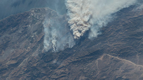
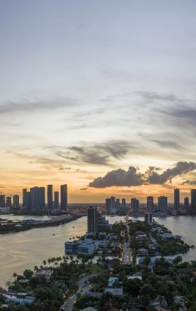
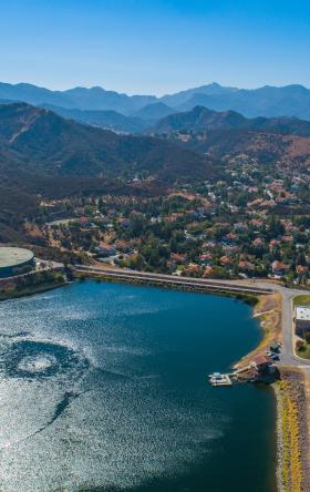
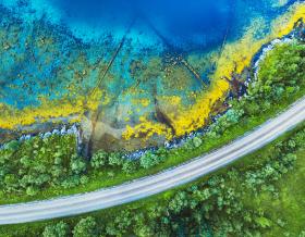
Image credit: Gateway to Astronaut Photography of Earth
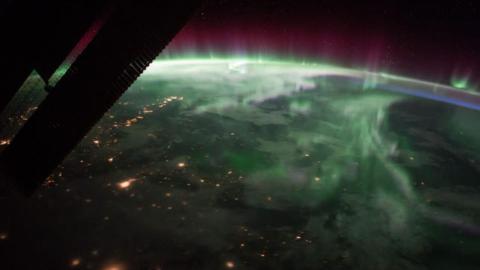
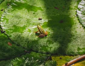
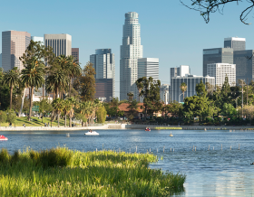
Image credit: Gateway to Astronaut Photography of Earth
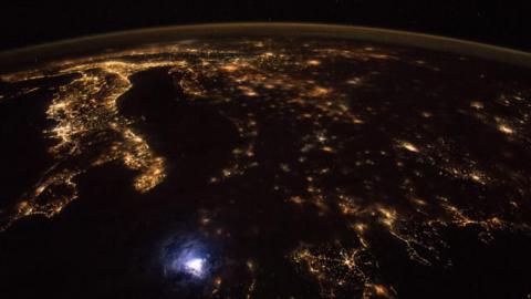
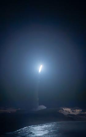
Image credit: Gateway to Astronaut Photography of Earth
Traveling at a speed of five miles per second, the team of six astronauts living and working aboard the ISS orbit Earth every 90 minutes. This team has a unique vantage point to document Earth’s dynamic environment including its geology, meteorology, geography, oceanography and ecology.
Down on Earth, Jacobs’ team of scientists at the Johnson Space Center (JSC) in Houston help provide these specialized, remote-sensing, science operations and observation services to the ISS program, including guiding astronauts to produce scientific photography and enhancing the imagery’s educational impact.
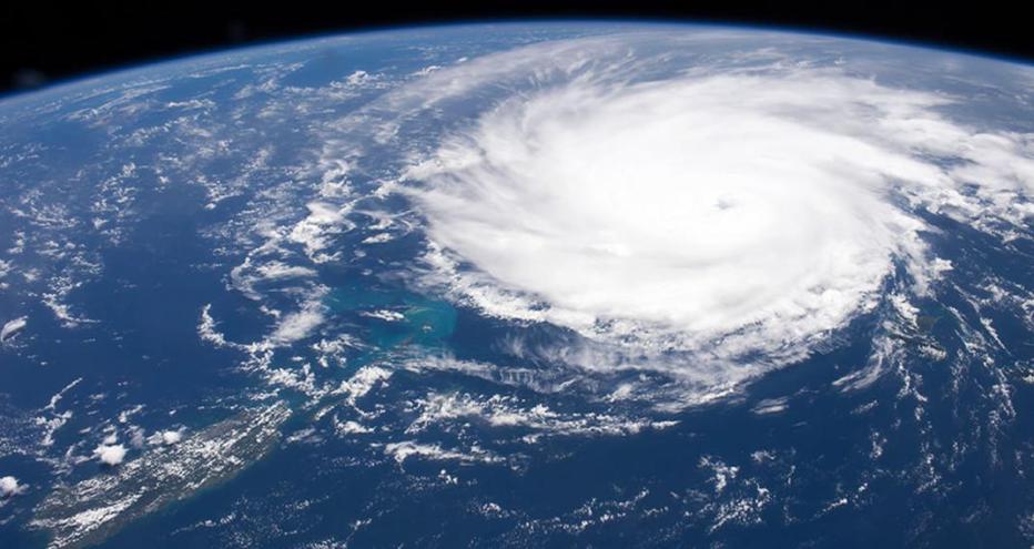
The ISS-generated images – capturing everything from impact craters, glaciers, volcanoes and aerosols to cities, storms and lightning and natural disasters – give primary data on the state of the Earth and compliment traditional automated sensor systems. In addition to the astronauts’ real-time observations using handheld cameras, the ISS’ orbital sensor systems provide a vital tool to identify the extent of damage from natural disasters and can even provide mapping support to aid response efforts on the ground.
Almost every day, new target image requests – a combination of scientific, educational, crew and public affairs needs – get added to the team database. The Jacobs team on ground checks the ISS orbit tracks alongside ground targets, the sun elevation angles for the target and weather conditions to ensure the crew can view the ground target requested. Once all checks are passed, the target will be included in the daily target capture list for the team aboard ISS.
When possible and applicable, the team at JSC will request the astronauts capture imagery before a natural disaster hits an area. This is primarily the case when a large tropical storm is forecasted to hit a specific area, as our team can keep up-to-date with when and where a storm will hit. Pre-storm and post-storm imagery is invaluable when assessing storm damage, including flooding, infrastructure damage, power outages and other factors.
Since 2012, we’ve delivered more than 4,200 images in support of the U.S. Geological Survey/Disaster Program documenting natural and humanmade disasters around the world, including Hurricane Florence and the Kilauea volcanic eruption in 2018.
During Hurricane Florence, a Category 1 hurricane in 2018, teams captured imagery of the hurricane as it formed. And in May 2018, teams captured a total of 116 images to of the Kilauea volcanic eruption.
Gateway to Astronaut Photography of Earth, the entire library of images captured from ISS, provides an enthralling look at the world around us, especially in times of need.
Want more? Read the article, "More Than a Bird's Eye View," in Civil + Structural Engineer Magazine.