


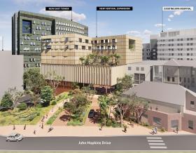


News

In 1973, the first functional cellphone in existence weighed two and a half pounds – a whopper in comparison to cellphones carried in pockets around the world today. With an average use time of nine and half hours, the cellphone granted users 35 minutes of talk time and required 10 full hours to recharge!
Today’s smartphones, by contrast, offer a broad range of functionality, including powerful geospatial analysis technologies at your fingertips. These technologies allow your phone to give you real-time directions (GPS) or surface nearby restaurants, gas stations or shopping opportunities while you’re out on the town. The geospatial analysis market is expected to reach $72 billion by 2021, offering wide applications to help combat some of the world’s toughest challenges, such as climate variability and disaster response and urban health, education, crime and economic development.
But what if we showed you how Jacobs is harnessing the power of location, integrating powerful geospatial analysis and visualization tools on mobile devices to streamline the process of identifying and prioritizing buildings with potential harmful vapor intrusion risks before they can impact human and infrastructure health?
reduction in level of effort – a reduction of 1.5+ weeks in time spent reporting and visualizing results
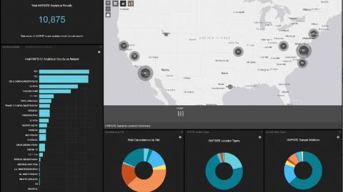
locations sampled with more than 10,000 sample results recorded to-date
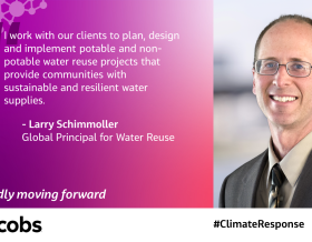
“High-resolution field instruments and automated tools help field and offsite project teams to visualize results in near real-time, allowing for better, faster collaboration and ultimately a more rapid decision-making process for government agencies and private companies.”
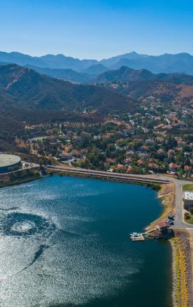
Vapor intrusion (VI) is a harmful process where chemicals in soil or groundwater underneath existing buildings migrate to indoor air, either through natural processes or through human occupant activities. VI can pose significant long- and short-term human health risks, inciting action on many corrective action plans and site cleanups.
For us, weighting, scoring, and siting of VI potential for buildings begins by extracting sample location data from the area of interest and performing a data reduction process to filter and normalize sample data for only valid sample results. Sample locations are then assessed for their maximum concentration values, which are used in the VI scoring process. The VI scoring process is built around our VI score card, an algorithmic model based on factors such as screening level, sample matrix and building scenario, to determine a VI score for each sample location. Sample locations are then spatially-enabled in a geographic information system (GIS) where they are intersected with spatial building data, using a defined area of influence around the building, or buffer. The building’s VI score is determined based on this spatial intersection and the process can be run on a specific area of interest, or on a much larger scale.
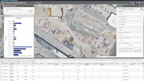
VI data and location information are delivered through our web mapping application, a sophisticated business decision support tool, that provides an interactive and intuitive interface for viewing the results of the analysis. This application helps users derive actionable data from the analysis for faster, more accurate decision making and planning.
Additionally, our mobile data collection tools make surveys and sampling more efficient, accurate and integrated across the enterprise, utilizing cloud-native GIS and chemical sensors that provides more rapid VI investigation results, analysis and reporting. We pair a mobile data collection application (that runs on a tablet or phone) with an industry standard air sampling sensor. Data from the devices sync to our cloud GIS platform which manages the data normalization, screening level comparisons and other analysis in a fully-automated way.
Results are instantly available on our web application and teams can view, query and run reports against the data. We layer in other critical datasets in both the mobile and web applications, so field and office teams can view chemical plumes, groundwater depth, utility lines and other information – helping the field teams more accurately sample and providing them information so they can make decisions on-the-go.
Jacobs’ field VI solution is a templated, integrated solution for fast deployment and instant data communication between project team members. Our system design supports rapid mobilization for emergency response efforts, so projects can be in the field, collecting data and analyzing results with no lag time. The solution is templated and configurable meaning the solution can be deployed in a cost-effective way and be customized to specific project needs.