


As a purpose-led company, we know we have a pivotal role to play in addressing the climate emergency. We consider this not only good business, but our duty to channel our technology-enabled expertise and capabilities toward benefitting people and the planet.


We work in partnership, delivering some of the most challenging, diverse and innovative projects and programs globally across multiple sectors. We integrate complex interfaces across planning, procurement and delivery to help unlock better social, environmental and economic outcomes from mega and giga projects.


For more than 30 years, Jacobs has been responsible for planning and implementing Lead and Copper Rule-related strategies which protect millions of people in the U.S. and Canada. Our work includes enhanced water quality monitoring strategies, sampling plan development, harvested pipe-scale analysis, lead service line inventories and replacement plans, corrosion control studies and the incorporation of equity and environmental justice considerations into compliance programs.



As our clients navigate the digital transformation and growing cyber risks, we have positioned ourselves at the forefront of this growth, adding digital capabilities, products and tools to serve a growing set of customers.


Sit down with our visionary team of thinkers, dreamers and doers to see what a day in the life is like.



A curated selection of some of the top-listened to and trending podcast episodes from our popular If/When podcast series, which has over 7M downloads to date.

Together with our visionary partner, PA Consulting, we're establishing our position in high end advisory services, creating a springboard to expand in high value offerings beyond the core.


At Jacobs, we're challenging today to reinvent tomorrow by solving the world's most critical problems for thriving cities, resilient environments, mission-critical outcomes, operational advancement, scientific discovery and cutting-edge manufacturing, turning abstract ideas into realities that transform the world for good. With approximately $16 billion in annual revenue and a talent force of more than 60,000, Jacobs provides a full spectrum of professional services including consulting, technical, scientific and project delivery for the government and private sector.


Jacobs. A world where you can.


As climate change threatens water security around the world, more communities are turning to water reuse as a resilient water supply solution and embracing the OneWater principle that all water has value. Jacobs has been supporting clients with water reuse programs for decades, beginning with the first applications of advanced wastewater treatment technologies in the 1960s. We provide our clients with a full range of services, from water reuse feasibility studies to design, construction and operations.



The only certainty about the future is uncertainty. Resilience is an attribute of a smarter planet, and requires planning and adapting ahead of potential threats. We help our clients survive, recover, adapt and thrive.


Jacobs is working to help clients across the United States secure federal funding for projects that make our cities and communities more connected and sustainable. Working hand-in-hand with clients from coast to coast and everywhere in between, Jacobs develops bold, innovative solutions to address the nation’s toughest challenges.


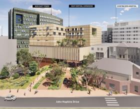
Now more than ever, we appreciate the hard work, sacrifice and dedication of the medical profession in ensuring the health and safety of our communities.


Together, we are stronger. Together, we can transform the future.

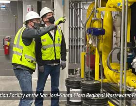
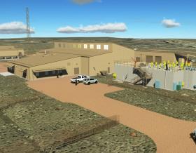
We’ve provided design-build services to the water sector for over 25 years and delivered more than 150 projects. We offer fully integrated design-build and design-build-operate capabilities to tackle the most complex water challenges and work in close collaboration with our clients.


Stories that capture our partnerships and innovative impact for a more connected, sustainable world


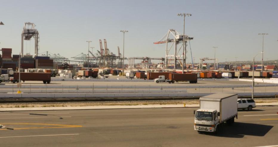
Los Angeles seemingly has it all – the glitz and glamor of Hollywood, sweeping hill and canyon-side views and 329 average days of sunshine annually to enjoy on one of many beaches.
The U.S.’s most populated county probably won’t be the first to pop up in an internet search of “transportation efficiency,” though. In fact, Los Angeles motorists spent more than 100 hours battling traffic congestion last year, earning the city a top spot on INRIX’s Global Traffic Scorecard for the sixth consecutive year in 2018.
But what if we showed you how dynamic travel planning and connected vehicle technology – implemented by one Los Angeles transportation agency with support from Jacobs – is clearing truck travel congestion, and the air while at it?
expected increase in freight and associated truck traffic volumes by 2035
hours spent in traffic annually by LA motorists
“Internet of Things technology serves as an enabler to improve issues faced by citizens, such as traffic congestion, flooding, access to broad band services, safety and security, lower utility costs among other services that enhance quality of life, attract businesses and empower economic prosperity.”

Brian Burkhard
Jacobs Global Technology Leader, Advanced Mobility Systems and Project Manager
An integral link in southern California’s transportation system, the I-710 South Corridor is the primary route in and out of the Ports of Long Beach and Los Angeles. Together these container ports, the two largest in the U.S., handle 25 percent of the nation’s export traffic and 40 percent of import traffic.
By 2035, the volume of freight and associated truck traffic along the corridor is expected to more than double – elevating severe congestion problems, including truck trip delays in and near the ports, and general traffic congestion for metropolitan area highways and arterials.
Ahead of these headaches, the Los Angeles County Metropolitan Transportation Authority (Metro) is leading an effort to build on the U.S. Department of Transportation’s Freight Advanced Traveler Information System (FRATIS) research, which began in 2012. Metro’s offshoot, called Drayage, Freight, and Logistics Exchange (DrayFLEX) , is now underway and will look to build upon previous concepts and deployments to explore how connected vehicle technology can improve goods movement, especially on Los Angeles’ roadways.
Aiming to provide freight-specific dynamic travel planning information to improve container movement in and around the ports, the project uses information from the marine terminal operators, trucking companies and traveler information systems to provide status updates on container availability, enable trucking companies to set up automated appointments and provide truck drivers the best routes to use to and from the port. Metro is testing the system on a fleet of 500 trucks throughout the current four-year project period, and Jacobs, as a member of the Cambridge Systematics team, is providing the planning, design and deployment of connected vehicle applications on freight trucks.
Integrating data from various resources including 3rd party data for port wait times, 511 for incident alerts and traffic and the California Department of Transportation and California Highway Patrol for road closures and restrictions, DrayFLEX helps streamline the efficiency of goods movements in and around the ports and along the I-710 South Corridor.
Using the integrated data, DrayFLEX provides messaging between the marine terminal and the fleets, essentially creating digital “handshakes” that signal container availability and dispatches for truck movement – helping balance early or late arrivals. Daily truck itineraries are then optimized for each driver – using data collected on average stop times, predicted travel times and expected downtime – to unlock potential truck optimizations that translate to fewer truck miles and improved air quality.
Adding connected vehicle technology to the DrayFLEX development opens the possibilities for seamless communication between the marine terminal and the fleets even more. Possible implementations may include dedicated short-range vehicle-to-vehicle communication and radar sensors and electronic engine control that could reduce energy consumption and improve traffic flow, while maintaining safety. As part of the DrayFLEX Project, the team is also studying additional connected vehicle applications focused on mobility, safety and the environment to provide even greater optimization.
DrayFLEX not only provides better management of truck traffic on freeways and arterials, but also improves flow of containers to and from distribution centers and reduces turn and waiting time at the ports. Reducing traffic congestion during peak times will be crucial as ports and roadways look to handle expected superships of 15,000 20-foot equivalent units (TEU) or greater soon.
The project is a key element in Metro’s larger The Gateway Cities Technology Plan for Goods Movement effort, that, in coordination with Gateway Cities Council of Governments, will provide a blueprint for an end-to-end information support system that can improve the efficiency of goods movement in southern California through the integration of traditional real-time road and traveler information technologies, along with intermodal freight, port and truck technologies. These enhancements to goods movement will supplement the larger capacity enhancements and operational improvement projects underway on the I-710 South Corridor, which Jacobs is also supporting to help find ways to make the corridor safer and easier to drive, improve air quality and public health and improve the freeway's design and traffic flow.