What if you could move actively through the center of car-centric Los Angeles without ever worrying about traffic?
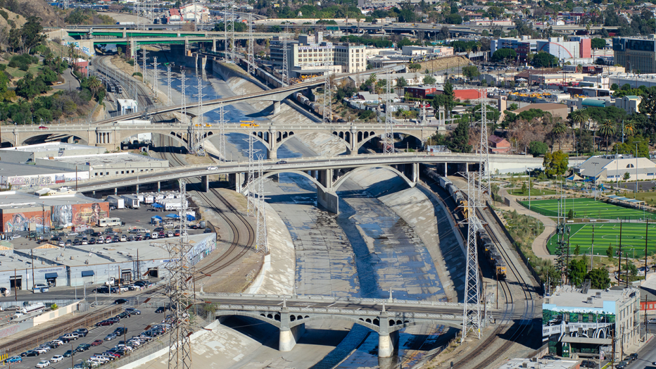
Well, the missing link in an ambitious downtown Los Angeles bike and pedestrian path is a few steps closer to completion. Located in a complex corridor beside the channelized Los Angeles River and through constrained urban and industrial areas, the LA River Path Project is a critical link not only for transportation, but for connecting neighborhoods on both sides of the river.
Once complete, this final 8-mile link will connect two existing path segments, resulting in a seamless 32-mile grade-separated regional multi-use corridor through the heart of Los Angeles County from Long Beach to the San Fernando Valley.
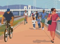
Jacobs, along with lead partner Alta Planning & Design, is supporting Los Angeles County Metropolitan Transportation Authority (Metro) on one of the biggest active transportation projects in the country. The team has created three alternatives for path development, each involving several path types and multiple access points. The overarching principles focus on a community-driven approach that enhances mobility, provides commute options and connectivity to employment hubs and high-quality transit lines and creates a safer, more comfortable environment for people biking and walking.
Following a multi-year outreach process and completion of the conceptual design report, Metro and Jacobs are advancing the design of the three alternatives into conceptual engineering services and preparing an Environmental Impact Report for public and regulatory authorities. Once approved, the team will prepare a final design package for construction, with expected completion in 2028.
“The last link in a much-needed transportation route in Southern California, the LA River Path will unite existing pedestrian and bicycle paths, connecting the northern valleys of Los Angeles to the seaside of Long Beach. This future active transportation path will enhance Los Angeles’ sustainable mobility goals and increase non-motorized transit, in addition to reducing regional greenhouse gas emissions. This project is one of the largest investments in the revitalization of the river to date and demonstrates Metro’s leadership in implementing environmentally, socially, and economically sustainable transportation options.”
Jacobs and Alta leveraged their experience from other joint projects of similar nature and complexity such as the Coachella Valley Link and Rail to River projects.
For decades, community groups and agencies have studied and planned for a river revitalization that involves restoration, recreation, active transportation and open space projects. And while this is an active transportation project designed to be the backbone of a separated and protected pathway connecting with Union Station, it’s so much more, with sustainability and resilience principles incorporated into every aspect.
Shifting to sustainable transportation and accessing City resources
The underlying premise of the entire regional multi-use corridor is to enhance non-vehicle mobility within the region. The LA River Path is supported by $365 million in dedicated funding by Los Angeles County voters in 2016 from the Measure M sales tax measure.
Well thought out access points along the path are designed to achieve multiple goals, including access to key community destinations such as schools, health care facilities, transit, and treasured City parks and green space.
Addressing social equity issues
The river has long acted as a physical barrier separating working class neighborhoods. Metro’s equity platform framework is designed so that access to opportunity is incorporated into public decision making and investments, and transportation is essential to enabling that access.
As part of community outreach and consultation the team identified equity focus communities (those most heavily affected by equity gaps) within 3 miles of the project corridor. They addressed equity considerations during the alternatives evaluation process so that the path takes into consideration the needs of the communities it will be serving.
Ultimately, the path will connect these communities with transit, job centers, and other key destinations such as parks (LA State Historic Park, Albion Park, and future 6th Street park). While the river is separated by railroads and utilities that use the same corridor, the path will allow people to get closer to the river and create a community destination.
Reducing the urban heat island and lowering greenhouse gases
One of the project’s goals is to use access points along the path to create open and green space for the surrounding park-poor communities. Designers are also evaluating innovative path paving materials, shade structures (with solar panels), and landscaping to reduce the heat island effect and provide respite for path users. The shift to an increasing active transportation mode share will contribute to lower greenhouse gas emissions in this heavily auto-dependent city.
Understanding community, river and regulatory challenges critical to project success
Working together with Metro staff, the Jacobs team assembled key community input and priorities from those living in and near the path area. Several outreach techniques were used including pop-up events, stakeholder roundtables, and community open house meetings, as well as online surveys.
Metro provided an excellent overview video from the conceptual design phase and alignment alternatives for those unable to attend any of the outreach events.
The team leveraged their deep technical understanding of the river and experience from other similar projects. Engineering challenges along this congested corridor include historic bridges, vertical channel walls, hydraulics, and adjacent railroad tracks and utility towers to the riverbank.
Many agencies within the bike path corridor had to be consulted, including the U.S. Army Corps of Engineers, Los Angeles County Flood Control District, the California Department of Transportation, Los Angeles Department of Water and Power, Mountains Recreation & Conservation Authority Metrolink, and the cities of Los Angeles and Vernon.
Connecting more people to more places in a more sustainable manner — the LA River Path will be the final link that not only bridges the gap between existing path segments but offers the opportunity to bring people and communities together. Working with Metro, our partners and the community, we can’t wait to deliver the final result.
A Metro project overview video showcases voices from community members who live in the study area.
“As a cyclist for 40 years, and the father of two boys who cycle – I’ve experienced first-hand the challenges with much of our bicycle / pedestrian infrastructure. As an engineer, I have devoted much of the last 15 years delivering projects along the river next to or near where this path will lie. I am poised to leverage these experiences: as a cyclist; as an engineer; and as someone knowledgeable of the challenges to be confronted, to lead this project to success.”
“I like to bike because it makes me active. ”
PROJECT FACTS
- More than 200,000 people live within 3 miles of the project. Of the 70,000 people of working-age, 26% (approximately 18,000) walk, bike or take transit to work.
- The River Bike Path will provide off-street commute options and provide a safer, more comfortable environment for everyone walking and biking in the area.
